Where is Pearl Harbor?
On December 7th, 1941, the US was drawn into WWII after Pearl Harbor was attacked by the Empire of Japan. News quickly reached people throughout the United States. Many of them consulted maps and asked, "Where is Pearl Harbor?" Understandably so, Pearl Harbor is located over 2500 miles from the United States mainland on the Island of Oahu in the Hawaiian Islands.
At the time of the attack, Hawaii was a territory of the United States. Hawaii was a kingdom, but because of the strategic importance of Pearl Harbor as a navy base (and other reasons), the Kingdom of Hawaii was overthrown in 1893 and Hawaii became a territory in 1898. In 1959, Hawaii became the 50th State.
The strategic importance of Pearl Harbor that caused Hawaii to become a territory is part of the reason for the Japanese attack on Pearl Harbor. Part of the reason that the attack was so successful was the impression of the commanders in Hawaii that the distance of Pearl Harbor from any other base was too great for an enemy to attack. The Japanese attack on Pearl Harbor was an incredible feat precisely for that reason.
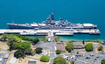
Pearl Harbor is a natural harbor that was dredged deeper to allow the United States Navy Ships to enter. It is an active naval base for the United States Navy and home to the Pacific Fleet.